
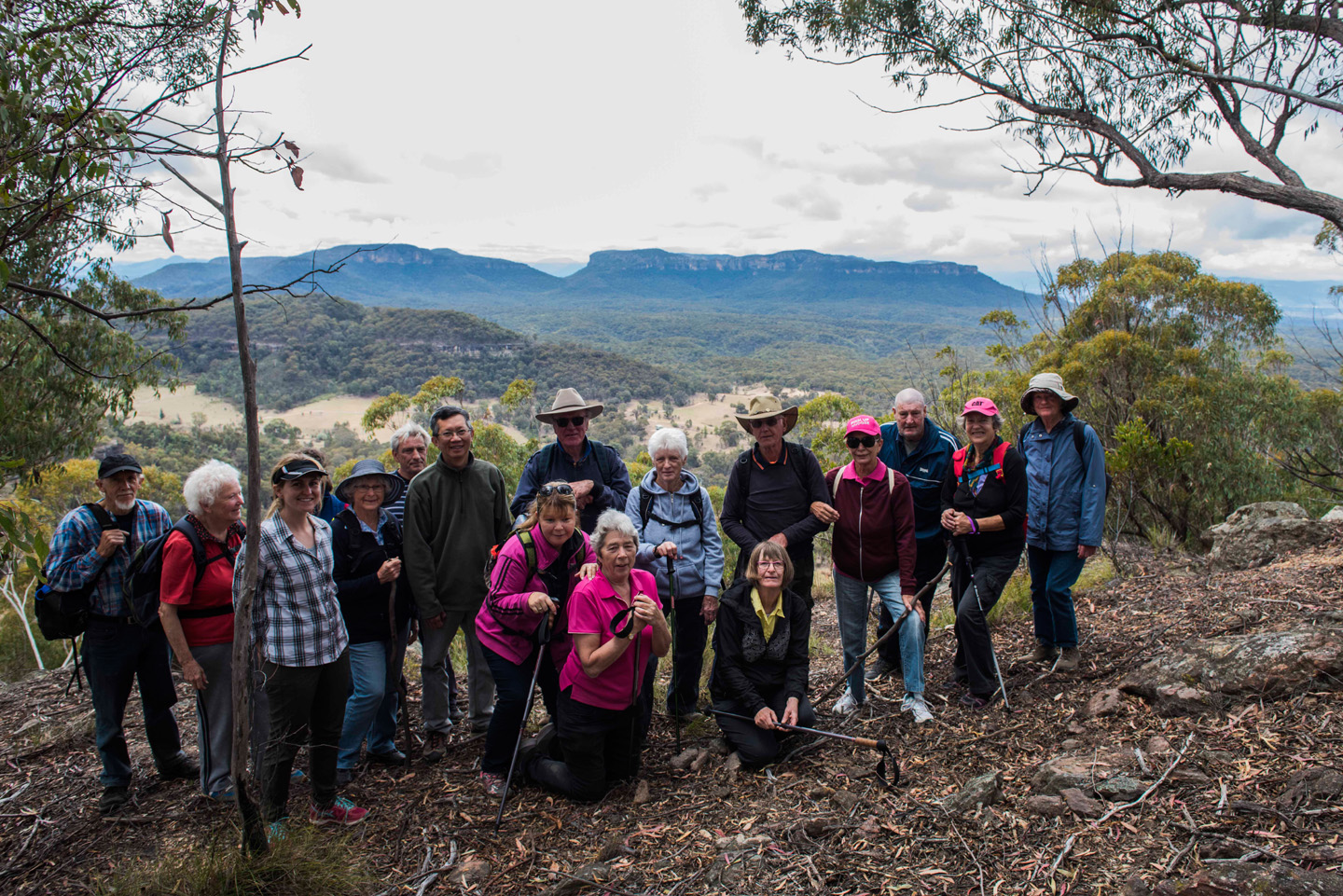
Blackmans’ Crown Capertee conquered today.. 20 walkers and perfect weather for bushwalking.
Joby
Hello fellow walkers.
Thank you all for joining Joby and Elly on our walk today. Hard going for some (me) and Joy our visitor.
But we all enjoyed it, the weather was good, the view was great, the company even better and a special thank you to the drivers who got us there and back safe and sound.
Elly


Date: Sunday 15th October 2017
Meet at Lovejoy St carpark at 9am
Re – meet at Capertee Rest stop at 10.15am (Toilet break)
Leaders: Elly Rands/Joby Mitchell
What to Bring:
Morning tea to share at the start of our walk
Hat to wear
Water to drink
Lunch to eat.
DESCRIPTION:
Grade – Easy to Medium (depending how fir you are)
BLACKMANS CROWN – Capertee 81km from Mudgee on the Castlereagh Hwy. allow 1hour+. No historic sites have been formally recorded, and no surveys have been undertaken. However mine adits, shafts, other works and some equipment and other relics associated with historical oil shale mining are located in the eastern part of the reserve, adjacent to the Castlereagh Highway.
Oil shale mining occurred in 1896, and possibly intermittently from 1905 to 1932, and involved the use of ponies and carts (Harcombe, 2004). The early phases were contemporaneous with larger scale mining at the nearby Torbane and New Hartley, under Mount Airly. Unusual rock cracking is present in sandstone outcrops on the northern part of Blackmans Crown ridge, which is likely to be a consequence of subsidence caused by these mines. A number of initials engraved on a rock outcrop below the summit of Blackmans Crown may also be of historical interest.
The reserve ranges in elevation from about 810 metres to just over 1000 metres. The prominent ridge of Blackmans Crown (1010m) extends southwards from the Great Dividing Range on the northern boundary. It forms a prominent rocky ‘pagoda’ landmark in the eastern part of the reserve. The land falls to east and west from this ridge, abruptly at first in vertical cliffs, before levelling out further west and north into gentle slopes.
The reserve lies on the western edge of the geological structure of the Sydney Basin, with sub-horizontal Sydney Basin sediments occurring over the whole reserve. Triassic age Narrabeen Sandstone is the youngest layer and outcrops in the cliffs and pagodas of Capertee Reserve Plan of Management JUNE 2011 12.