
Abercrombie Caves
Date: 20 May 2018 (Sunday)
Description/Location: Abercrombie Karst Conservation Reserve, via Trunkey Creek
Approx. 55klm south of Bathurst (sealed road).
Leader: Joby Mitchell
Report: Joby Mitchell
Images: Joby Mitchell and Sof Lee
Map Ref: Topographic Bathurst SI/55-8
Details/Description of Walk: An early start (AGAIN) departing Mudgee 7:30am Morning Tea stop in Bathurst in the park 9:00am arrival after 10:00am.

We commenced our walk from the picnic ground; after members posing for a group photo; after purchasing entry tickets from the National Parks Ranger at the kiosk. Here we were each given a very informative map for our use. Approx 800m past the kiosk and after eyeing off an overhead suspension bridge-constructed 1950 (this bridge is to provide access to the caves during floods), we took a right hand turn between the Grove Bluff and the entrance of the cave. We took the 100 or so steps up and over the cave admiring the view and the colours of the rock face alongside the track, known as Coops bluff. We did also figure out where the sinkhole (doline) was before we descended another 100 or so steps down and around “Betsie’s downfall” pondering at the name; with multiple suggestions from the group.

As we were descending Margaret was busy admiring the little wrens that appeared to travel with us. We followed the path and turned right to locate Stable Arch (upsteam). This arch is said to been used as a hideout for escaped convicts and the known “Ribbon Gang” led by surname Entwistle, in the 1830’s. The arch is large enough to have hidden the gangs horses.
We then retraced our step to be met with a small bridge at the Northern entrance of the Archway the smaller cave in known as Bushrangers Cave.
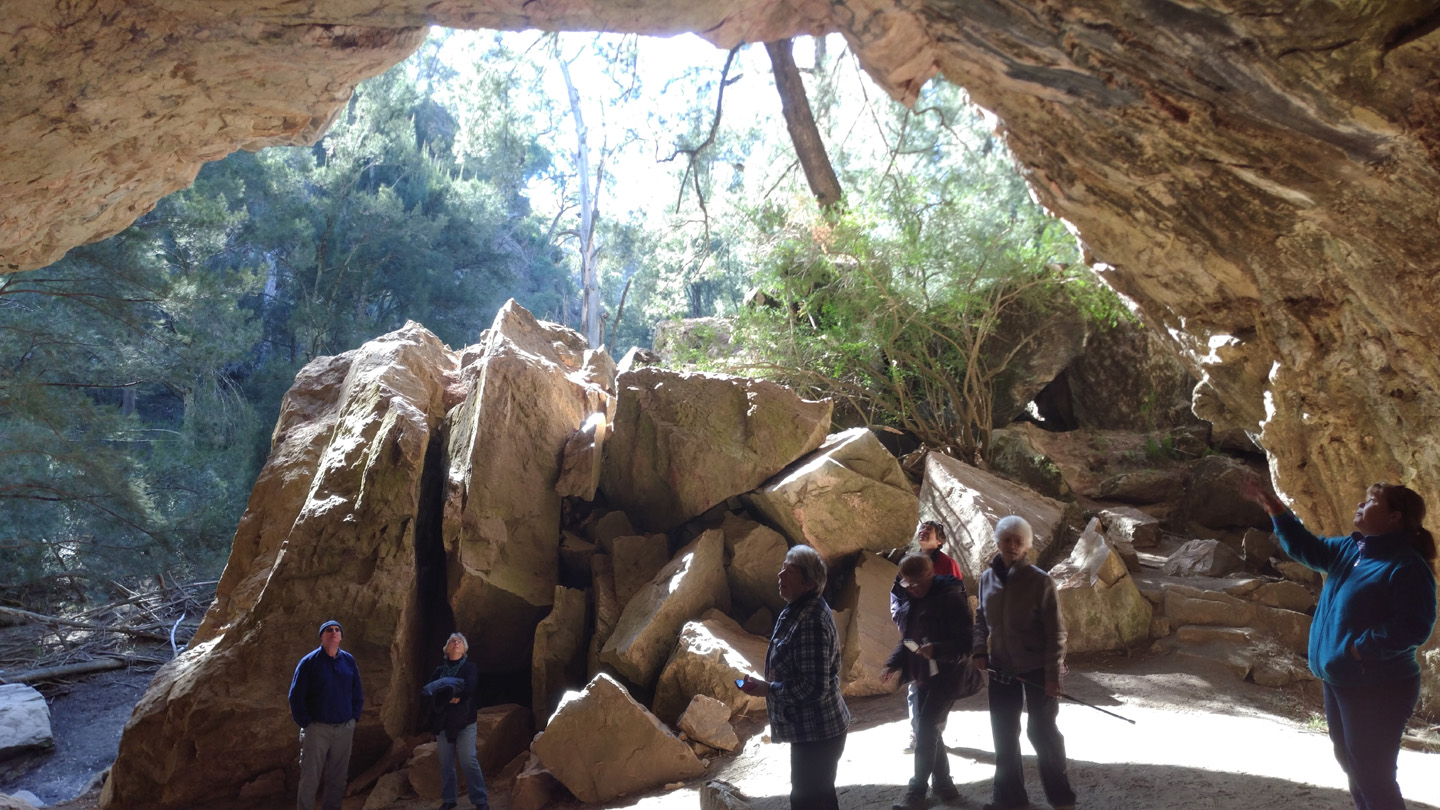
We then opened the magic gate and was met with the magnificent view entrance to the Archway. This cave was formed by Grove Creek making its cut through the hill, (4 million years ago), thereby creating the Grand Arch. The Grand Arch, a through-cave is approximately 200 metres long, averaging 40m wide and with a maximum height of 32m. As you wonder through the cave with interpretive signs along the way and lights to depict some significant features, we crossed a suspension bridge and some took the tall ladder for a better view.


We tested out the dance floor and re-routed a little to follow the dry creek bed to the exit of the cave.
A great description of how the road above was formed ad you enter the area (entry road) with the word “scree” new to some. (me).
Then some members could not resist the “suspension bridge” that we had seen on the way to the cave and tested it out. Hoping to include a picture of those rascals /members.

On our return we settled in for some pre-packed lunch with thermos in hand enjoying autumn – and a lyrebird kept us in check.
Journey home – all safe and sound.
Members on walk. 10
Distance: Travel: 199.6klm from Mudgee to Caves – so double that. Walk: 3-4 klm –multiple walks available.
Comment: From Mudgee this is a 2.5 hr drive but definitely worth the visit. Autumn is a good time, options to camp. Facilities have good shower/toilet and laundry. Small kiosk. Great Picnic ground. Members completed a self guided tour of the Archway Cave, guided tours are available, best to book. Interpretive signs along the way very educational as you forget to look at the brochure/map.
You must be logged in to post a comment.